
February 9 Storm Wrap-Up
WeatherBuddha $ay$: Not Bad
It was too windy for any aerial photography today so I didn’t want to risk sending the drone up.
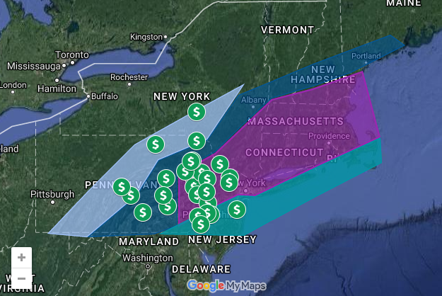
The map below contains my noon update from yesterday with points of interest as an overlay. The shaded regions correspond with my predicted amounts. Click on a point of interest to see the actual snowfall totals for that location. All snowfall totals were obtained from the National Weather Service (Binghamton NY, and Mount Holly, NJ).
A clipper system will move through the region over the weekend and many will see light snow, followed by temperatures in the 40s.