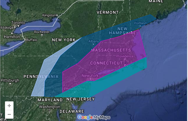
February 8-9 Winter Storm
Snow lovers rejoice!
We are a little over 24 hours away from the (up to this point) heaviest snowfall of the 2016-2017 winter season!
Why is this happening?: The storm that went through today essentially paved the way for a stronger, colder storm to form tomorrow night. (Think of it as a person hiking in front of you, blazing a trail with a machete…you just have to follow the path of least resistance.) The storm will rapidly intensify and deepen, resulting in heavy snow for the Northern Mid Atlantic States and New England.
Timing: Snow will overspread the region from west to east starting tomorrow night after 10 PM.
Duration: This will be a 12-15 hour event for most areas in the shaded regions on the map.
How to read the map: Click a shaded region to see forecast details for the area. Use your mouse wheel to zoom in or out.
Comments are welcome! (Account creation is required).

